October 20, 2014
Pictures taken on Mars by Curiosity
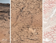
A chapter of the layered geological history of Mars is laid bare in this postcard from NASA's Curiosity rover. Image credit: NASA/JPL-Caltech/MSSS | The Chemistry and Camera (ChemCam) instrument on NASA's Mars rover Curiosity used its laser to examine side-by-side points in a target patch of soil, leaving the marks apparent in this before-and-after comparison. Image credit: NASA/JPL-Caltech/LANL/ CNES/IRAP/LPGN/CNRS |
This color panorama shows a 360-degree view of the landing site of NASA's Curiosity rover, including the highest part of Mount Sharp visible to the rover. Image credit: NASA/JPL-Caltech/MSSS | This image shows the tracks left by NASA's Curiosity rover on Aug. 22, 2012, as it completed its first test drive on Mars. Image credit: NASA/JPL-Caltech |
This mosaic image with a close-up inset, taken prior to the test, shows the rock chosen as the first target for NASA's Curiosity rover to zap with its Chemistry and Camera (ChemCam) instrument. Image credit: NASA/JPL-Caltech/MSSS/LANL | This full-resolution image from NASA's Curiosity shows the turret of tools at the end of the rover's extended robotic arm on Aug. 20, 2012. Image credit: NASA/JPL Caltech |
This mosaic image shows part of the left side of NASA's Curiosity rover and two blast marks from the descent stage's rocket engines. Image credit: NASA/JPL-Caltech | This image taken by NASA's Curiosity shows what lies ahead for the rover, Mount Sharp. Image Credit: NASA/JPL-Caltech |
More pictures from Mars on Nasa website.
Published in: